
Quick answer
Nuwara Eliya is in Sri Lanka's Central Province, near the middle of the island, at about 1,890 metres in the highest part of the hill country. It lies roughly 77 kilometres south-east of Kandy, about two and a half to three hours by road, and roughly 60 kilometres north-west of Ella, about two to two and a half hours. Colombo is roughly 170 kilometres away, five to six and a half hours by car. The nearest railway station is Nanu Oya, about 8 to 10 kilometres from town.
Key takeaways
- Nuwara Eliya is the capital of Nuwara Eliya District in Sri Lanka's Central Province.
- Nuwara Eliya lies roughly 77 kilometres from Kandy, a drive of about two and a half to three hours over the Ramboda Pass.
- Nanu Oya, roughly 8 to 10 kilometres from Nuwara Eliya, is the town's railway station on the Kandy to Badulla line.
- Horton Plains National Park is roughly an hour by road south of Nuwara Eliya.
- Pidurutalagala, Sri Lanka's highest mountain at 2,524 metres, rises directly behind Nuwara Eliya.
Where Nuwara Eliya is on the map
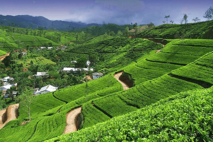
Nuwara Eliya is in the Central Province of Sri Lanka, close to the centre of the island and roughly 170 kilometres east of Colombo. It occupies a high valley at about 1,890 metres, ringed by hills and overlooked by Pidurutalagala, the highest mountain in the country at 2,524 metres.
Nuwara Eliya is the capital of Nuwara Eliya District, which covers most of the central tea country, including Hatton, Talawakele and the Maskeliya valley below Adam's Peak. To the east, beyond Hakgala, the land falls towards Uva Province and Ella.
- →Province: Central.
- →District: Nuwara Eliya.
- →Altitude: about 1,890 metres.
- →Neighbouring towns: Kandy to the north, Hatton to the west, Ella and Badulla to the east.
Distances and drive times
Nuwara Eliya's drive times are longer than distances suggest, because hill roads wind and climb. Allow more than the figures below in rain, in April and on holiday weekends. A private car and driver is the most common way to move around the region.
Nuwara Eliya also sits on the railway via Nanu Oya, roughly 8 to 10 kilometres away. The train links it with Kandy, Colombo, Ella and Badulla, and the stretch from Nanu Oya to Ella is among the most scenic railway journeys on the island.
- →Colombo or the airport: roughly five to six and a half hours by road.
- →Kandy: roughly two and a half to three hours.
- →Ella: roughly two to two and a half hours.
- →Hatton: roughly an hour and a half.
- →Horton Plains: roughly an hour.
Where Nuwara Eliya fits on a route
Nuwara Eliya fits naturally between Kandy and Ella on the classic Sri Lanka loop. Travellers drive up from Kandy over the Ramboda Pass with a tea factory stop, spend a night or two, then take the train from Nanu Oya to Ella or drive on via Horton Plains.
Nuwara Eliya can also be reached straight from Colombo, either by road through Avissawella and Hatton or by train. That suits travellers who start in the hills and finish on the beach. Lankan Stays & Trails often uses Nuwara Eliya as the high point of a route that runs from the Cultural Triangle to the south coast.
- →North to south: Sigiriya, Kandy, Nuwara Eliya, Ella, then the coast or Yala.
- →West to east: Colombo, Hatton, Nuwara Eliya, Ella, Arugam Bay.
- →Short trip: Colombo, Kandy, Nuwara Eliya and back.
The highest town on the usual route
Nuwara Eliya is the highest town most visitors stay in. Kandy sits at about 500 metres and Ella at about 1,000. That altitude explains the climate, the tea and the vegetables, and it means the town is often above or inside the clouds.
Nuwara Eliya's altitude rarely causes problems. Most travellers notice mild breathlessness on the first steep slope and nothing more. Horton Plains, over 2,000 metres, is higher again, and the walk there feels harder than the same distance would at sea level.
What is close to Nuwara Eliya
Nuwara Eliya has a cluster of sights within about ten kilometres: Gregory Lake, Victoria Park, Galway's Land, Pedro Tea Estate, Lover's Leap, Moon Plains, Hakgala Botanical Garden and the Seetha Amman Temple. Most can be reached by tuk-tuk in under 25 minutes.
Nuwara Eliya is also within reach of bigger day trips: Horton Plains, Ambewela farm, Labookellie estate, Ramboda Falls, Devon and St Clair's falls near Talawakele, and, with a very early start, Adam's Peak. Those make it a good base for two or three nights.
Frequently asked questions
Where is Nuwara Eliya located?
Nuwara Eliya is located in the Central Province of Sri Lanka, near the middle of the island, at about 1,890 metres. It lies between Kandy to the north and Ella to the east, and is the nearest town to Horton Plains National Park.
How far is Nuwara Eliya from Colombo?
Nuwara Eliya is roughly 170 kilometres from Colombo, a drive of about five to six and a half hours depending on traffic and the route. The train from Colombo Fort to Nanu Oya, the nearest station, takes longer but is far more scenic.
How far is Nuwara Eliya from Kandy?
Nuwara Eliya is roughly 77 kilometres from Kandy, a drive of about two and a half to three hours over the Ramboda Pass. Most travellers stop at a tea factory and Ramboda Falls on the way. The train runs from Kandy to Nanu Oya.
Is Nuwara Eliya near Ella?
Nuwara Eliya is fairly near Ella, roughly 60 kilometres away, about two to two and a half hours by road. The train from Nanu Oya to Ella takes roughly two and a half to three hours and is one of the most scenic rail journeys in Sri Lanka.
Which province is Nuwara Eliya in?
Nuwara Eliya is in the Central Province of Sri Lanka, which also includes Kandy and Matale. It is the capital of Nuwara Eliya District, which covers the main tea-growing area around Hatton, Talawakele and the Maskeliya valley.
Does Nuwara Eliya have a railway station?
Nuwara Eliya does not have its own railway station in the town. The nearest is Nanu Oya, roughly 8 to 10 kilometres away on the Kandy to Badulla line. Tuk-tuks and taxis meet trains for the 20 to 30 minute ride into town.